Section 1
Tryon to Campobello
March 10, 2022
6.5 Miles
“You have to give up your hiking and long-distance walking.”
Those words came from Dr. Pande, my endocrinologist. She had been my diabetes specialist for the last 8 years. This short, dark-haired and dark-skinned Indian woman had been recommended to me by another physician friend. “She’s a little unorthodox,” he said, “but she will take good care of you.” Dr. Pande and I developed a love/hate relationship. I think she loves to take care of me, to help me get through diabetes. And I hate it when she tells me things, especially things I do not want to hear. But she is strong-willed and determined and does not let me get by with much. Her concern for me was not so much my blood sugar, but one of the side effects of my diabetes. I have diabetic neuropathy and cannot feel anything in my feet. I did not realize how much of our balance depends on the feet feeling things. I found that I could walk on fairly even ground well, but rocks and roots, which used to not bother me, now caused me to lose my balance and fall. She was concerned about blisters, cuts, and nails coming through my shoes that I would not feel or know about until the end of the day.
“But I walk about 4 ½ miles every day,” I told her, only half-lying. The truth was I walked 4 ½ miles every day 3 days a week. Or 2. Or 1. Most weeks. “Okay,” she said, “you can walk 3 ½ miles, but then you have to stop.” “How about this?” I countered. “I walk 3 ½ miles, stop, take a break and check my feet, and if nothing is wrong, walk another 3 ½ miles?” My walking pace is about 20 minutes per mile, so this would take about an hour and ten minutes. I figured I could do four of these a day. “Okay,” she finally said, “you can walk 3 ½ miles in the morning, take a break for lunch, check your feet, then 3 ½ in the afternoon. But no further!” “But…” “No further!” she said. “Alright, seven miles a day it is,” I resigned. “And only one day a week, at most,” she said. I remembered a term from the Rumpole of the Bailey books- She-who-must-be-obeyed. “Yes, ma’am,” I said. She smiled at me. I love her smile.
Dr. Pande was not the only one who was hesitant for me to do this walk. My wife, Cathy, was concerned. She did not want me walking on a highway, even one that does not have much traffic for most of the day. “I’ll watch out for the cars,” I said. “I’ll wear an orange vest. I’ll be careful.” “It’s not you,” she said. “It’s those crazy drivers. I don’t want you to be hit by someone who’s looking down at their cellphone.” “People don’t do that,” I said. “You do,” she came back at me. I hate it when she’s right. But she also knows that walking like this and talking to people along the way is one of the things that give me joy in my life (besides just being with her), so she reluctantly lets me go without too much fussing.
The South Carolina part of US Highway 176 starts at the NC/SC border at Tryon, NC. Tryon is a pretty little town nestled at the foot of the Blue Ridge mountains, beside the Saluda grade, the first real hill you climb into the mountains. It began as a railroad town, with the steepest incline up to Saluda on the eastern seaboard. Trains would stop in Tryon to add an extra engine to make it up the mountain. Over time Saluda became a resort town. People would come from other places in the northeast or from the coast to spend summers in the relatively cool climate, among the waterfalls of the area. Sidney Lanier, the famous poet from Georgia, kept a home in Tryon. He went there thinking the climate could help him with his tuberculosis, which he contracted while a prisoner of war during the Civil War. In the mid 1930’s F. Scott Fitzgerald would travel from Baltimore or New York to Tryon, to spend time trying to overcome his bouts with TB and his alcoholism. Later, when is wife Zelda was in a psychiatric hospital in Asheville, he would stay in Tryon. Perhaps the most famous person from the area was Nina Simone. The singer-songwriter-civil rights activist was born there in 1933. There is a statue of her in town at the “Nina Simone Plaza” and her childhood home is being preserved as a national historic place. For clergy and storytellers among us, Frederick Buechner spent his early teen years in Tryon and was baptized there.
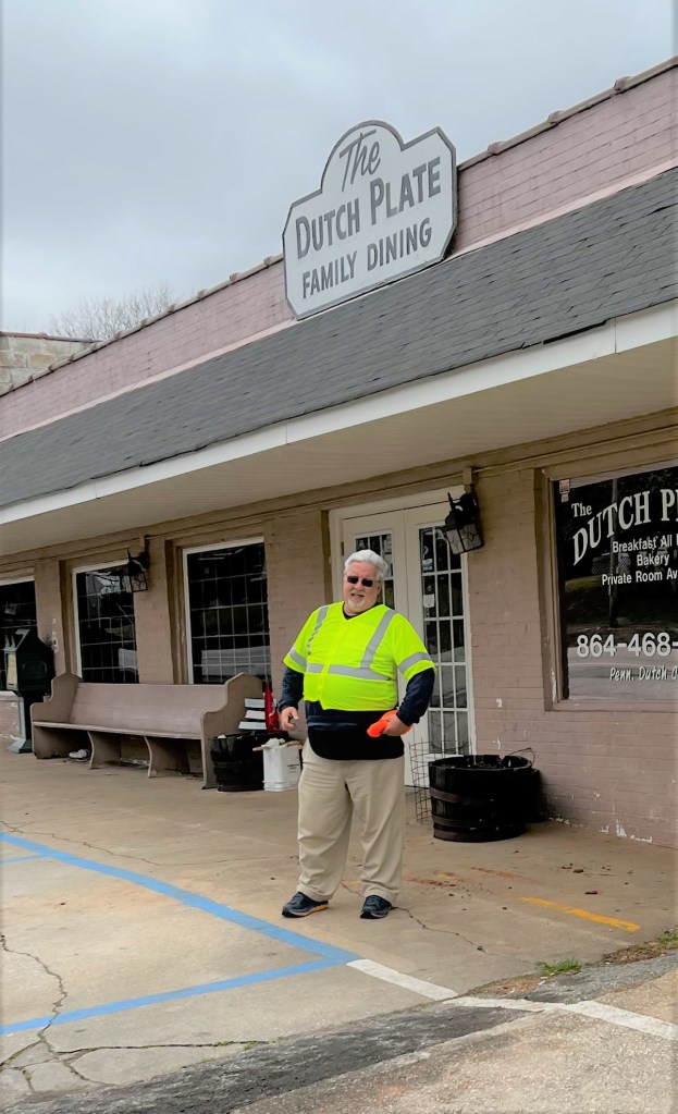
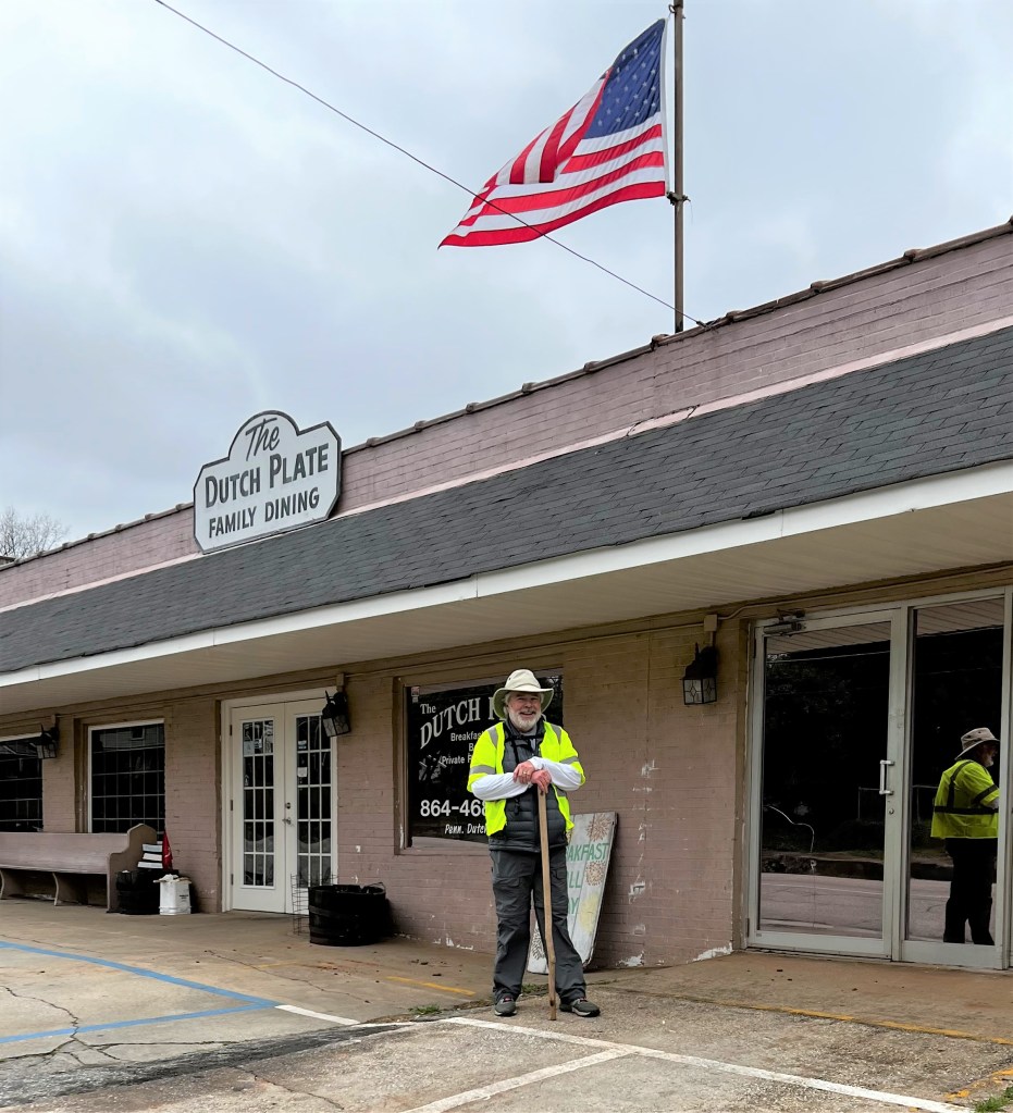
Six and a half miles east of Tryon is the little town of Campobello. My friend Jim Hunter, another retired United Methodist minister and quite an avid walker himself offered to walk with me on some of these first sections. We decided to meet in Campobello at the Dutch Plate Diner, leave one car there, drive up to Tryon, and walk back. I got to the Dutch Plate about 20 minutes before Jim, got out of the car, pushed the buttons on the door to lock it, and walked in. I sat down in the diner, ordered a cup of coffee from the nice waitress, and realized I had locked my keys in the car. Thirty minutes later and eighty-five dollars lighter, I got my keys. Patrick Farrell, the owner of the Dutch Plate was very friendly, He asked about what I was doing and wanted to know if I needed anything. Years ago I read Blue Highways by William Least Heat-Moon. As he traveled across the country on the small highways, the ones printed in blue on the maps, he stopped at a lot of diners. He said you could tell how good one was by the number of different insurance company calendars on the check-out counter. The Dutch Plate had four. I plan to eat there next time I come through.
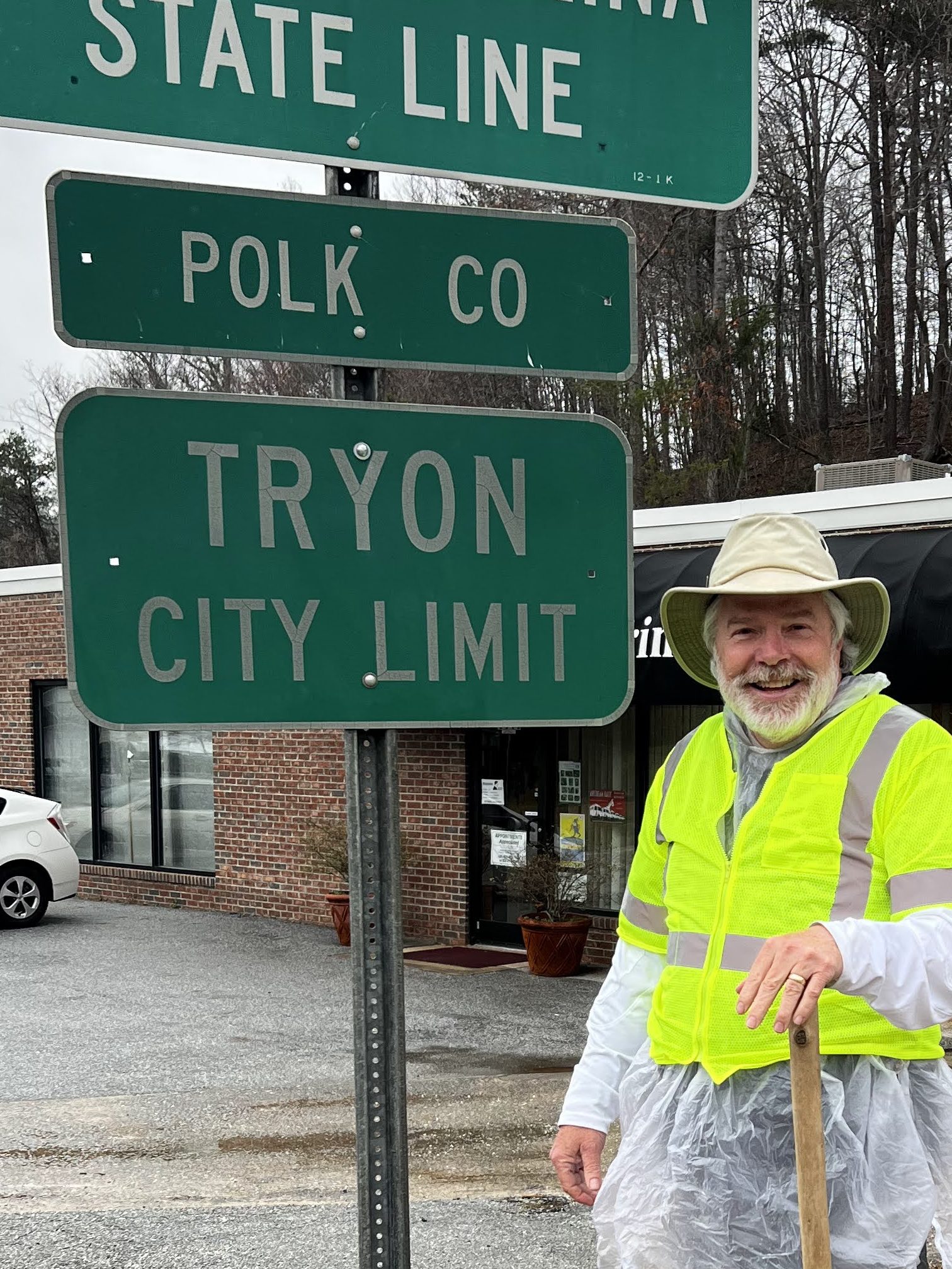
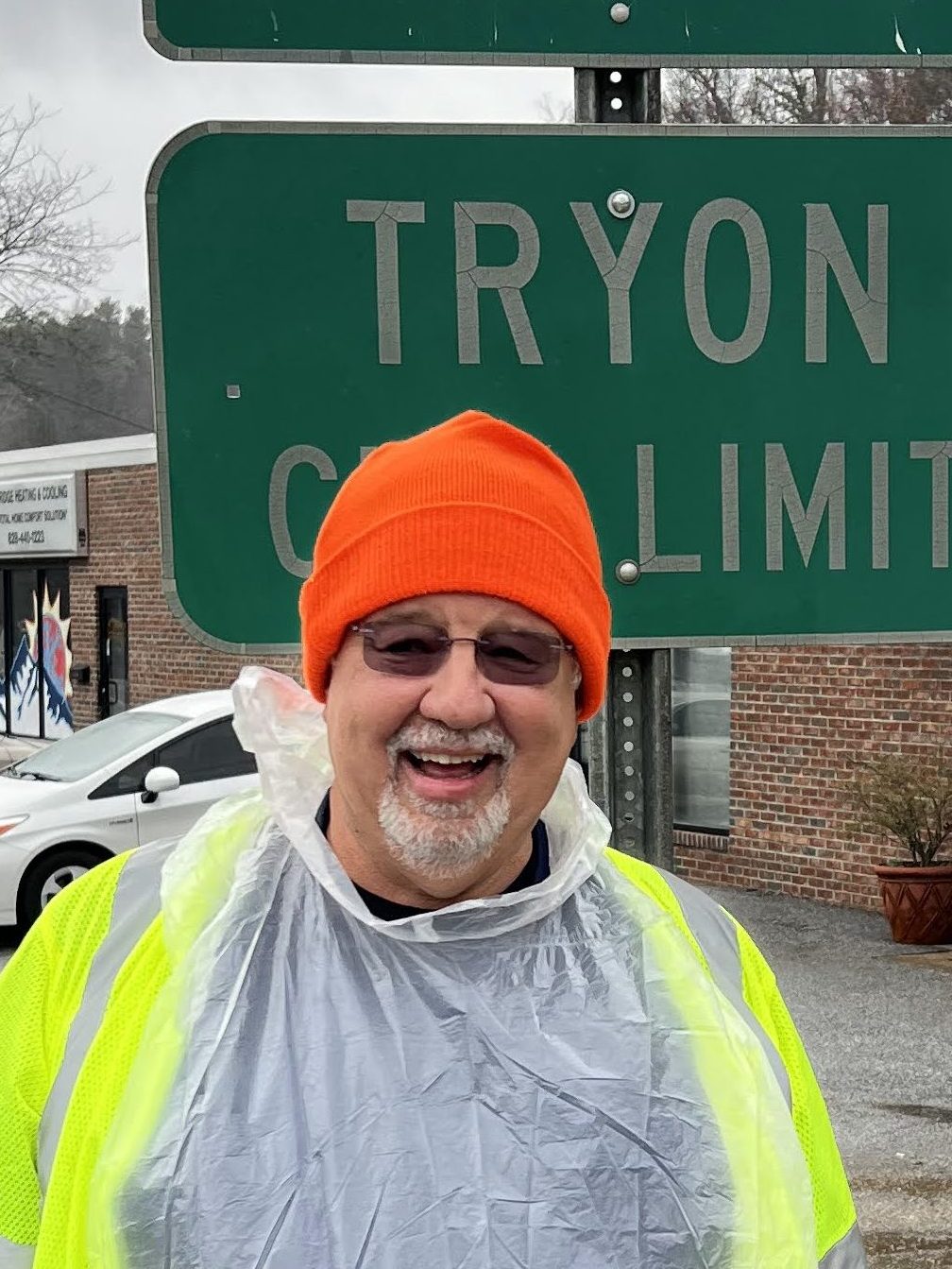
Jim and I drove to Tryon, parked the car near the state sign, and stepped out into the light rain.
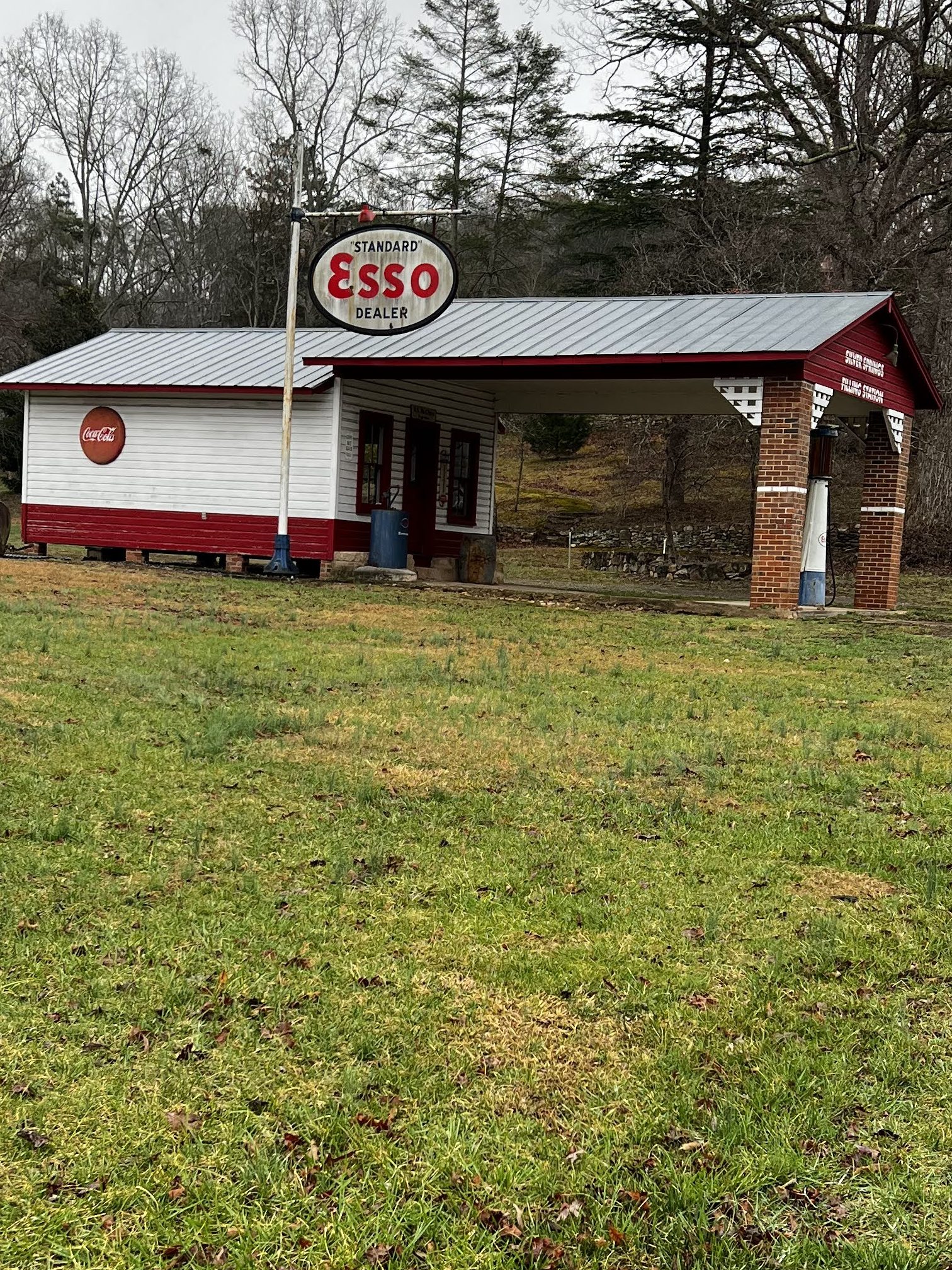
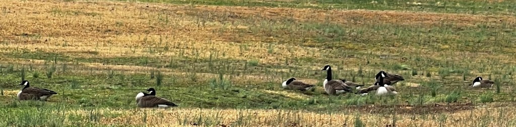
The first quarter-mile from Tryon the road goes uphill. It always takes me a few minutes at the beginning to get my heart rate up and to not be gasping for breath, so I began the trudge up the hill. Immediately on the left was an old Esso station, somewhat restored, but not in any use. We stopped by to see the sign and any of the other memorabilia there. Immediately two jokes from my early teen years came to mind. “Why did the bee fly cross country with its legs crossed? It was looking for a BP station?” and “What kind of bees use the Esso station? Esso bees.” Jokes that were funny for a 13-year-old don’t have the same impact on this 68-year-old sense of humor. But the memories are nice. A flock of geese landed in the field by the Esso station and honked us on our way.
We crested the hill and began the rolling terrain towards Landrum. Jim noticed all the empty mini-bottles on the side of the road. Turns out the favorite brand of liquor for litterbugs is Bombay Gin.
The walk to Landrum is about 2 miles and took us about 40 minutes. When entering Landrum on the left is a restored train depot. We walked by it, past the newspaper office (where my aunt worked for a while), and turned left onto the main business area.
Landrum was settled by early pioneers coming from Pennsylvania, Maryland, and Virginia. The fertile land, which was free, and a good climate made it a great place to start farming. Corn and timber were the first products. Later cotton, vegetables, beef, and pork were produced on the farms. In the early 1930s peaches became the major crop (and there are still a lot of peach orchards in the area), then apples. Textiles moved in in the late 1940’s and were dominant until the mid-1970s. The railroad extending into Landrum in 1880 caused the settlement to need a name. Originally called Landrum Station, after John Landrum, the donor of the land for the depot, it was later shortened to Landrum. Oddly, John Landrum, a Baptist minister from nearby Spartanburg, never lived in his namesake town.
With the downturn in textiles, Landrum began to diversify in terms of industry. The old buildings from downtown have been saved and many are specialty shops, restaurants, and boutiques. Landrum has the best Habitat for Humanity ReStore I have visited. If you are looking for good bargains on old antiques that may have been in these foothills homes, this is the place. Taking advantage of the number of horse lovers in the area (Tryon has an annual steeplechase, The Blockhouse), the Foothills Equestrian Nature Center (FENCE) is located just outside of town. Landrum has been able to retain that small-town feel while being welcoming to many new people moving into the area.

Jim and I walked through the business district, chose El Chili Rojo for lunch, and enjoyed a good meal. The staff was friendly but busy, so we didn’t get the chance to speak.
Following lunch, we headed back out to the highway. The four and a half miles to Campobello were mostly rolling hills and flatland. Halfway between the two towns Landrum High School, home of the Cardinals, is on the left. A large, relatively new building houses the 610 students and around 60 staff. It is a highly ranked school both in the state and nationally.
About 3 o’clock we arrived in Campobello. Campobello is a small town with a population of 675. For a while it was a textile town, but (as with Landrum) textiles moved out in the 1970s. Landrum has a few businesses and some farmland, but most people moving there work in Spartanburg. They live in Landrum for the quietness of the country and the lower cost of land and housing.
Prior to the Civil War, a family in Spartanburg operated a large farm operation in the area. Mary Dean Davis, one of the owners, would ride out on horseback to check on the farm. She would often stop on Windmill Hill, look out towards the South Pacolet River, and enjoy the view. One day she looked at it and said “Campo Bella”, which means (in Italian) “Beautiful Field.” The name Campobella stuck. In 1882 the town was incorporated and the name changed to Campobello, the ‘a’ being changed to ‘o’ due to poor penmanship on the town charter.
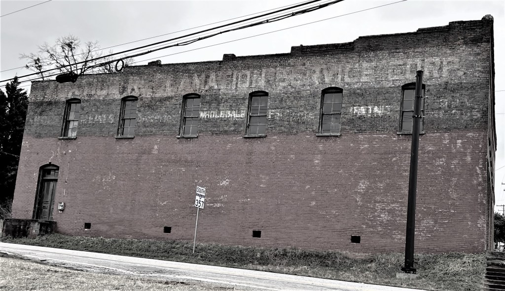
As Jim and I walked through the town, it was pretty much deserted. I have been collecting photos of “ghost signs” (signs that were painted on buildings years ago and have mostly faded). There was one in Campobello, so I took a photo. Jim drove me back to the car in Tryon, we said goodbye and headed home.